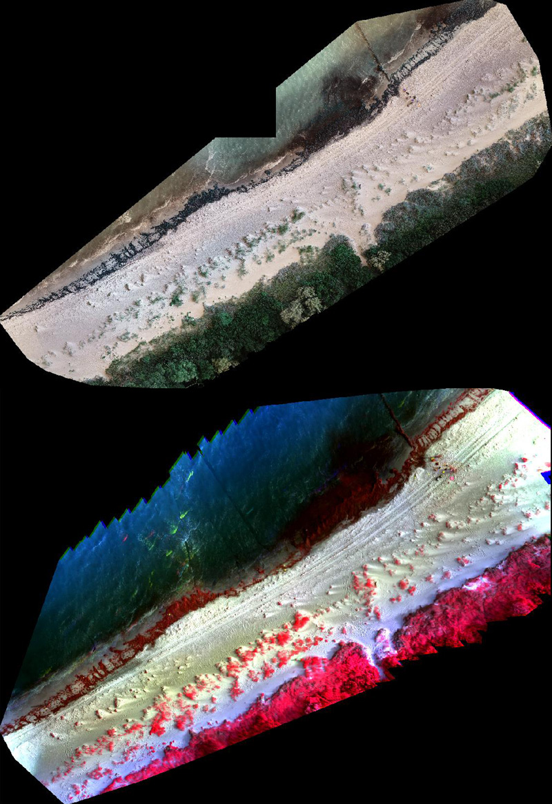
Beach wrack monitoring at our two German sampling sites on the island of Poel and Kühlungsborn had valuable support from the Geodesy and Geoinformatics Department of the Faculty of Agricultural and Environmental Sciences at the University of Rostock. Two different drone systems, which were equipped with infrared cameras, were used in parallel to the standard drone/camera setup on the beaches. From the air, the quantity of the stranded beach wrack can be better verified over a larger beach section of e.g. 100m length. These images were supplemented with differential GPS data (Real Time Kinematic) in order to be able to georeference locations in high quality. Furthermore, 3-D images will complete the characterisation of the beach topography. All the data will be analysed and evaluated as part of a master thesis at the Department of Geodesy and Geoinformatics. We are very happy about this helpful cooperation and are looking forward to the results!
Photographs (Island of Poel, DE) are courtesy of Florian Beyer, Faculty of Agricultural and Environmental Sciences, Uni Rostock.